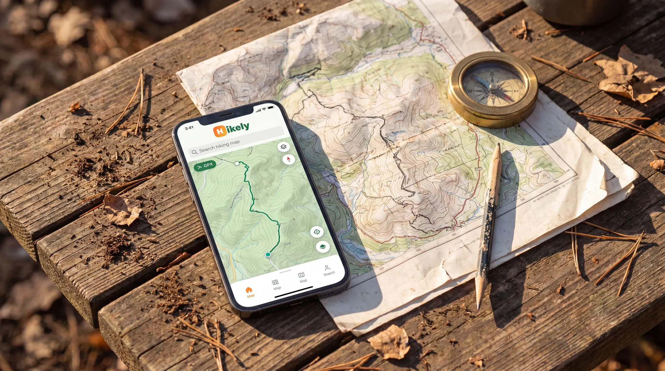
Hikely ΓÇö Trail Your Story
Now on iOS & Android

Trail Your
Story

Record every step with precision GPS. Discover trails worldwide. Share your adventures with a community that gets it.

Scroll
Lycian Way Kaçkar Traverse St. Paul Trail Carian Trail Cappadocia Loop Phrygian Way Hittite Trail Evliya Çelebi Way Lycian Way Kaçkar Traverse St. Paul Trail Carian Trail Cappadocia Loop Phrygian Way Hittite Trail Evliya Çelebi Way
0
Trails Mapped
0
Km Recorded
0
Active Hikers
0
Countries

Built for people who
actually hike

Not another generic fitness app. Hikely was designed by thru-hikers, for every kind of trail ΓÇö from a morning walk to a multi-day expedition.

01

Works Without Signal

Full offline GPS recording. No cell tower needed. Your trail data is stored locally and syncs when you're back in range.

02

Survives Everything

App killed? Phone rebooted? Recording continues. Native background services keep tracking when other apps give up.

03

Social, Not Noisy

Share routes, photos, and stories with fellow hikers. A community that cares about trails, not likes. No algorithm noise.

Everything you need,
nothing you don't

From day hikes to multi-day expeditions ΓÇö precision tools that stay out of your way.

Native GPS Recording

Precision tracking that runs in the background. Works offline, saves your full route locally.

Live Elevation

Real-time elevation gain, loss, and altitude profile. See every climb as it happens.

Waypoints & POIs

Mark water sources, camps, viewpoints. Import GPX files with full waypoint support.

Trail Discovery

Browse curated trails, filter by difficulty and distance. Save favorites for later.

Social Feed & Stories

Share your hikes, follow friends, post 24-hour stories. A feed built for outdoor moments.

Photos & Journal

Auto-attach photos to GPS breadcrumbs. Relive every summit and sunset back home.

Every climb,
every descent.

Watch your adventure unfold as a live elevation profile. Understand every hill before you meet it ΓÇö celebrate every summit after.

Γåæ 1,450 m gain Γåô 820 m loss 12.3 km 4h 22m
Lycian Way ┬╖ Stage 4
Kaş → Finike · Coastal mountains
LIVE
SUMMIT 1,450m
12.3 km
Distance
1,450 m
Elevation
4:22
Duration

Three steps to
your next adventure

1

Discover

Browse trails near you or worldwide. Filter by distance, difficulty, and elevation gain.

2

Record

Tap start and go. Hikely tracks GPS, elevation and pace ΓÇö even with screen off or offline.

3

Share

Your hike becomes a story. Attach photos, add notes, share with your group or the world.

The mountain is
calling.

Download Hikely free. Built by hikers, for hikers.